Geolocate

Roseville topographic map

Interactive map

Click on the map to display elevation.

About this map

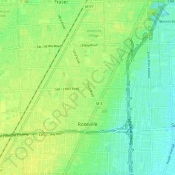
Name: Roseville topographic map, elevation, terrain.

Location: Roseville, Macomb County, Michigan, 48066, United States (42.47981 -82.96899 42.53978 -82.90314)

Average elevation: 187 m

Minimum elevation: 178 m

Maximum elevation: 192 m

Other topographic maps

Click on a map to view its topography, its elevation and its terrain.

Harrison Charter Township

United States > Michigan > Macomb County

Harrison Charter Township, Macomb County, Michigan, United States

Average elevation: 177 m

Chesterfield Township

United States > Michigan > Macomb County

Chesterfield Township, Macomb County, Michigan, United States

Average elevation: 184 m

Lake Saint Clair

United States > Michigan > Macomb County

Lake Saint Clair, Macomb County, Michigan, United States

Average elevation: 177 m

Washington Township

United States > Michigan > Macomb County

Washington Township, Macomb County, Michigan, 48095, United States

Average elevation: 240 m