
Kwun Tong District topographic map
Interactive map
Click on the map to display elevation.
About this map
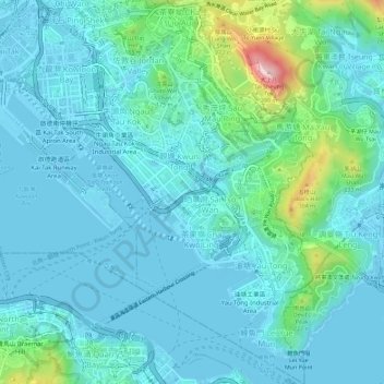
Name: Kwun Tong District topographic map, elevation, terrain.
Location: Kwun Tong District, Kowloon, Hong Kong, China (22.28228 114.20171 22.33496 114.24558)
Average elevation: 61 m
Minimum elevation: -23 m
Maximum elevation: 399 m
Other topographic maps
Click on a map to view its topography, its elevation and its terrain.
Mong Tseng Tsuen
China > Hong Kong > Tin Shui Wai > Mong Tseng Tsuen
Mong Tseng Tsuen, Tin Shui Wai, Yuen Long District, New Territories, Hong Kong, China
Average elevation: 6 m