
Val-d'Oise topographic map
Interactive map
Click on the map to display elevation.
About this map
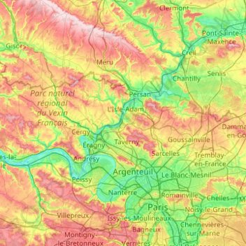
Name: Val-d'Oise topographic map, elevation, terrain.
Location: Val-d'Oise, Ile-de-France, Metropolitan France, France (48.90867 1.60776 49.24143 2.59504)
Average elevation: 98 m
Minimum elevation: 17 m
Maximum elevation: 237 m
Other topographic maps
Click on a map to view its topography, its elevation and its terrain.