
La Médaille topographic map
Interactive map
Click on the map to display elevation.
About this map
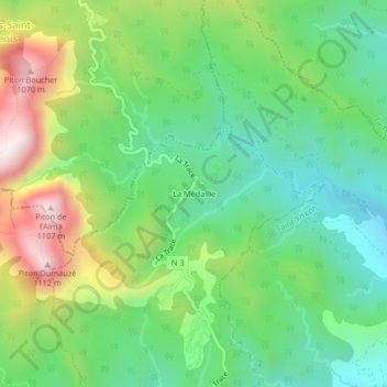
Name: La Médaille topographic map, elevation, terrain.
Location: La Médaille, Fort-de-France, Martinique, France (14.68191 -61.10753 14.72191 -61.06753)
Average elevation: 568 m
Minimum elevation: 287 m
Maximum elevation: 1,089 m
Other topographic maps
Click on a map to view its topography, its elevation and its terrain.
Fort-de-France
France > Martinique > Fort-de-France > Fort-de-France
Fort-de-France, Martinique, 97200, France
Average elevation: 42 m
Ravine Vilaine
France > Martinique > Fort-de-France
Ravine Vilaine, Fort-de-France, Martinique, 97200, France
Average elevation: 136 m