
Cañada de Caracheo topographic map
Interactive map
Click on the map to display elevation.
About this map
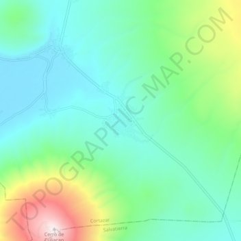
Name: Cañada de Caracheo topographic map, elevation, terrain.
Location: Cañada de Caracheo, Cortazar, Guanajuato, México (20.33483 -100.98612 20.41483 -100.90612)
Average elevation: 1,995 m
Minimum elevation: 1,725 m
Maximum elevation: 2,844 m