
Poole topographic map
Interactive map
Click on the map to display elevation.
About this map
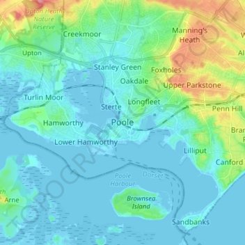
Name: Poole topographic map, elevation, terrain.
Location: Poole, South West England, England, BH15 1SU, United Kingdom (50.67795 -2.02152 50.75795 -1.94152)
Average elevation: 16 m
Minimum elevation: -7 m
Maximum elevation: 87 m