
Lowden topographic map
Interactive map
Click on the map to display elevation.
About this map
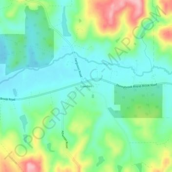
Name: Lowden topographic map, elevation, terrain.
Location: Lowden, Yabberup, Western Australia, Australia (-33.55613 115.95343 -33.51613 115.99343)
Average elevation: 137 m
Minimum elevation: 89 m
Maximum elevation: 243 m
Western Australia trails, hiking, mountain biking, running and outdoor activities