
Sunda topographic map
Interactive map
Click on the map to display elevation.
About this map
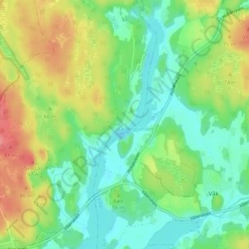
Name: Sunda topographic map, elevation, terrain.
Location: Sunda, Moss, Viken, 1591, Norway (59.45195 10.75573 59.49195 10.79573)
Average elevation: 50 m
Minimum elevation: 22 m
Maximum elevation: 97 m