
Stonyfell topographic map
Interactive map
Click on the map to display elevation.
About this map
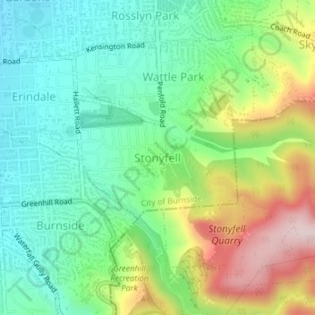
Name: Stonyfell topographic map, elevation, terrain.
Average elevation: 235 m
Minimum elevation: 108 m
Maximum elevation: 476 m
Other topographic maps
Click on a map to view its topography, its elevation and its terrain.
Mount Osmond
Australia > South Australia > Mount Osmond
Mount Osmond, City of Burnside, South Australia, 5064, Australia
Average elevation: 260 m