
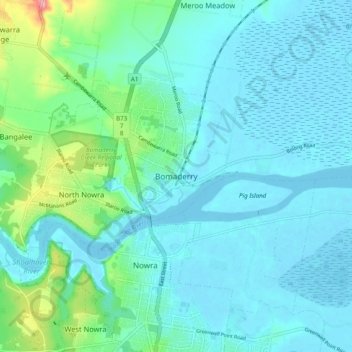
Bomaderry topographic map
Interactive map
Click on the map to display elevation.
About this map
Name: Bomaderry topographic map, elevation, terrain.
Average elevation: 21 m
Minimum elevation: -7 m
Maximum elevation: 134 m
Other topographic maps
Click on a map to view its topography, its elevation and its terrain.
Bomaderry
Australia > New South Wales > Bomaderry
Bomaderry, Shoalhaven City Council, New South Wales, 2541, Australia
Average elevation: 18 m