
Glenroy topographic map
Interactive map
Click on the map to display elevation.
About this map
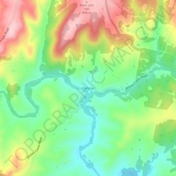
Name: Glenroy topographic map, elevation, terrain.
Location: Glenroy, Lithgow City Council, New South Wales, Australia (-33.56833 150.12833 -33.52833 150.16833)
Average elevation: 760 m
Minimum elevation: 655 m
Maximum elevation: 911 m
New South Wales trails, hiking, mountain biking, running and outdoor activities