
Pangkalpinang topographic map
Interactive map
Click on the map to display elevation.
Pangkalpinang
The city's topography is generally undulating and hilly, with an altitude of 20–50 metres (66–164 ft) above sea level. Hilly areas are primarily in the west and south, including Mount Girimaya (50 metres above sea level) and Tower Hill. A 290-hectare (720-acre) urban forest is in the Old Village area. An area of 1,562 hectares (3,860 acres) is under cultivation for food crops, fisheries and forestry. Fallow land is 1,163 hectares (2,870 acres), and 4,130 hectares (10,200 acres) are developed. The remaining 2,085 hectares (5,150 acres) are swamps and forest.
About this map
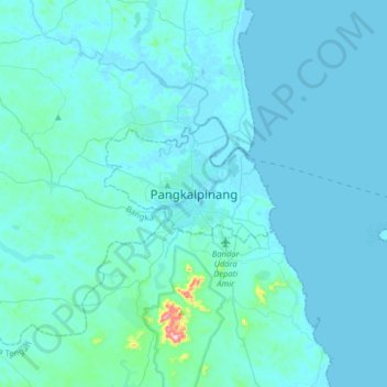
Name: Pangkalpinang topographic map, elevation, terrain.
Location: Pangkalpinang, Bangka-Belitung Islands, 33125, Indonesia (-2.28067 105.95346 -1.96067 106.27346)
Average elevation: 20 m
Minimum elevation: -2 m
Maximum elevation: 383 m