
和平县 topographic map
Interactive map
Click on the map to display elevation.
About this map
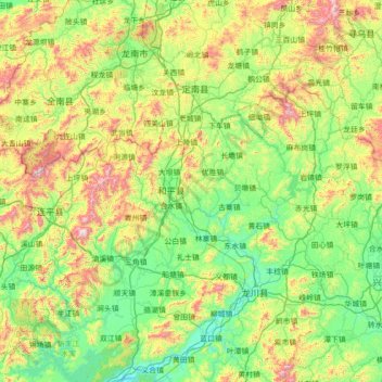
Name: 和平县 topographic map, elevation, terrain.
Location: 和平县, Heyuan City, Guangdong, China (23.80004 114.36828 25.08004 115.64828)
Average elevation: 351 m
Minimum elevation: 37 m
Maximum elevation: 1,324 m
Other topographic maps
Click on a map to view its topography, its elevation and its terrain.
Guangzhou City
China > Guangdong > Guangzhou City
Guangzhou, Yuexiu District, Guangzhou City, Guangdong, 510030, China
Average elevation: 21 m
Nanhu Sub-district
China > Guangdong > Shenzhen City > Nanhu Sub-district
Nanhu Sub-district, Luohu District, Shenzhen City, Guangdong, 518000, China
Average elevation: 29 m