
Cartago Province topographic map
Interactive map
Click on the map to display elevation.
About this map
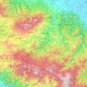
Name: Cartago Province topographic map, elevation, terrain.
Location: Cartago Province, Costa Rica (9.48431 -84.08812 10.14731 -83.31560)
Average elevation: 1,374 m
Minimum elevation: 2 m
Maximum elevation: 3,786 m
Other topographic maps
Click on a map to view its topography, its elevation and its terrain.