
Megamendung topographic map
Interactive map
Click on the map to display elevation.
About this map
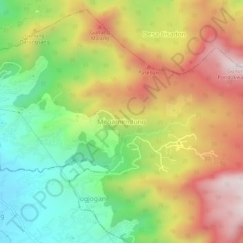
Name: Megamendung topographic map, elevation, terrain.
Location: Megamendung, West Java, 16750, Indonesia (-6.66345 106.92469 -6.62345 106.96469)
Average elevation: 1,095 m
Minimum elevation: 701 m
Maximum elevation: 1,544 m