
Moore Creek topographic map
Interactive map
Click on the map to display elevation.
About this map
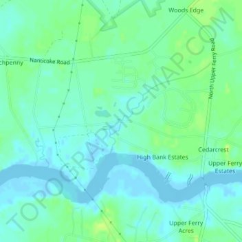
Name: Moore Creek topographic map, elevation, terrain.
Average elevation: 6 m
Minimum elevation: -2 m
Maximum elevation: 14 m
Other topographic maps
Click on a map to view its topography, its elevation and its terrain.
Annapolis
United States of America > Maryland > Annapolis
Annapolis lies within the humid subtropical climate zone (Köppen Cfa), with hot, humid summers, cool winters, and generous precipitation year-round. Low elevation and proximity to the Chesapeake Bay give the area more moderate spring and summertime temperatures and slightly less extreme winter lows than…
Average elevation: 8 m