
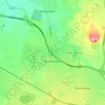
Mitchell Park topographic map
Interactive map
Click on the map to display elevation.
About this map
Name: Mitchell Park topographic map, elevation, terrain.
Location: Mitchell Park, City of Ballarat, Victoria, Australia (-37.53370 143.74466 -37.48447 143.82349)
Average elevation: 442 m
Minimum elevation: 396 m
Maximum elevation: 521 m
Victoria trails, hiking, mountain biking, running and outdoor activities
Other topographic maps
Click on a map to view its topography, its elevation and its terrain.