
Umbertide topographic map
Interactive map
Click on the map to display elevation.
About this map
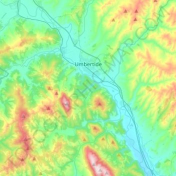
Name: Umbertide topographic map, elevation, terrain.
Location: Umbertide, Perugia, Umbrien, 06019, Italien (43.19948 12.16796 43.36269 12.41475)
Average elevation: 411 m
Minimum elevation: 211 m
Maximum elevation: 957 m