
Kaatsheuvel topographic map
Interactive map
Click on the map to display elevation.
About this map
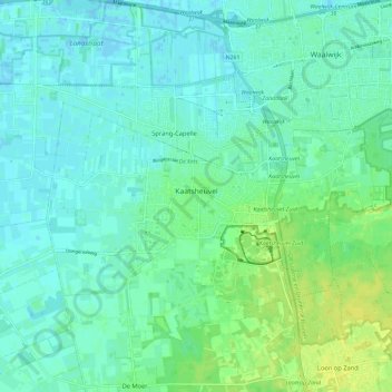
Name: Kaatsheuvel topographic map, elevation, terrain.
Location: Kaatsheuvel, Loon op Zand, North Brabant, Netherlands (51.64074 4.98726 51.67683 5.10411)
Average elevation: 5 m
Minimum elevation: -2 m
Maximum elevation: 15 m
Other topographic maps
Click on a map to view its topography, its elevation and its terrain.