
Koudekerke topographic map
Interactive map
Click on the map to display elevation.
About this map
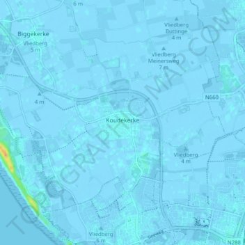
Name: Koudekerke topographic map, elevation, terrain.
Location: Koudekerke, Veere, Zeeland, Netherlands (51.46225 3.50911 51.50098 3.58698)
Average elevation: 0 m
Minimum elevation: -4 m
Maximum elevation: 27 m
Other topographic maps
Click on a map to view its topography, its elevation and its terrain.
Noord-Beveland
Netherlands > Zeeland > Noord-Beveland
Noord-Beveland, Zeeland, Netherlands
Average elevation: 0 m
Oosterschelde
Netherlands > Zeeland > Schouwen-Duiveland
Oosterschelde, Schouwen-Duiveland, Zeeland, Netherlands, 4485PA, Netherlands
Average elevation: 0 m