
De Westereen topographic map
Interactive map
Click on the map to display elevation.
About this map
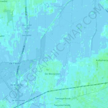
Name: De Westereen topographic map, elevation, terrain.
Location: De Westereen, Dantumadiel, Friesland, Nederland (53.24064 6.01111 53.29087 6.05497)
Average elevation: 1 m
Minimum elevation: -5 m
Maximum elevation: 5 m
Other topographic maps
Click on a map to view its topography, its elevation and its terrain.
Damwâld
Nederland > Friesland > Dantumadiel > Damwâld
Damwâld, Dantumadiel, Friesland, Nederland, 9104, Nederland
Average elevation: 1 m
Driezum
Nederland > Friesland > Dantumadiel > Driezum
Driezum, Dantumadiel, Friesland, Nederland, 9114, Nederland
Average elevation: 0 m
Kuikhorne
Nederland > Friesland > Dantumadiel > Kuikhorne
Kuikhorne, Dantumadiel, Friesland, Nederland, 9287, Nederland
Average elevation: 1 m