
Ghent topographic map
Interactive map
Click on the map to display elevation.
About this map
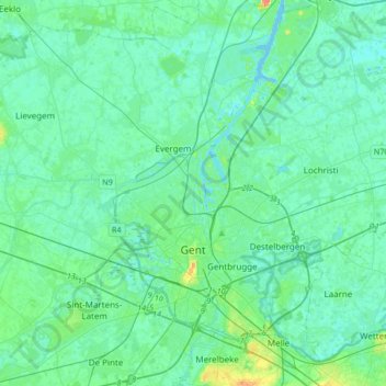
Name: Ghent topographic map, elevation, terrain.
Location: Ghent, Gent, East Flanders, Flanders, Belgium (50.97954 3.57976 51.18889 3.84933)
Average elevation: 7 m
Minimum elevation: -4 m
Maximum elevation: 41 m