
Guajará-Mirim topographic map
Interactive map
Click on the map to display elevation.
Guajará-Mirim
Guajará-Mirim is a municipality in the Brazilian state of Rondônia. It is located at an altitude of 128 meters. Its population was 46,556 (2020) and its area is 24,856 km².
About this map
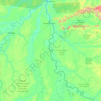
Name: Guajará-Mirim topographic map, elevation, terrain.
Average elevation: 153 m
Minimum elevation: 105 m
Maximum elevation: 463 m
Other topographic maps
Click on a map to view its topography, its elevation and its terrain.