
Sint-Oedenrode topographic map
Interactive map
Click on the map to display elevation.
About this map
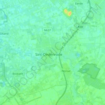
Name: Sint-Oedenrode topographic map, elevation, terrain.
Location: Sint-Oedenrode, Noord-Brabant, Nederland, 5491AN, Nederland (51.52591 5.42571 51.60591 5.50571)
Average elevation: 12 m
Minimum elevation: 6 m
Maximum elevation: 29 m
Other topographic maps
Click on a map to view its topography, its elevation and its terrain.
Everse
Nederland > Noord-Brabant > Sint-Oedenrode
Everse, Sint-Oedenrode, Meierijstad, Noord-Brabant, Nederland, 5491 ST, Nederland
Average elevation: 12 m