
Catsop topographic map
Interactive map
Click on the map to display elevation.
About this map
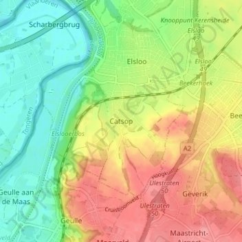
Name: Catsop topographic map, elevation, terrain.
Location: Catsop, Elsloo, Stein, Limburg, Nederland, 6181, Nederland (50.92048 5.74703 50.96048 5.78703)
Average elevation: 72 m
Minimum elevation: 33 m
Maximum elevation: 117 m
Other topographic maps
Click on a map to view its topography, its elevation and its terrain.