
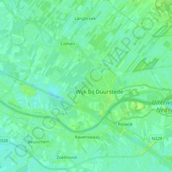
Wijk bij Duurstede topographic map
Interactive map
Click on the map to display elevation.
Wijk bij Duurstede
Dutch Topographic map of the municipality of Wijk bij Duurstede, 2013.
About this map
Name: Wijk bij Duurstede topographic map, elevation, terrain.
Location: Wijk bij Duurstede, Utrecht, Netherlands (51.95492 5.25627 52.00008 5.39495)
Average elevation: 5 m
Minimum elevation: -4 m
Maximum elevation: 15 m