
Brasschaat topographic map
Interactive map
Click on the map to display elevation.
About this map
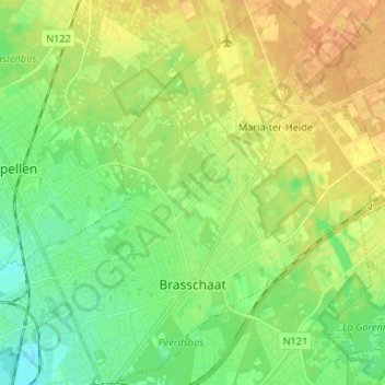
Name: Brasschaat topographic map, elevation, terrain.
Location: Brasschaat, Antwerp, Flanders, 2930, Belgium (51.26864 4.44024 51.35088 4.55873)
Average elevation: 14 m
Minimum elevation: -1 m
Maximum elevation: 28 m
Other topographic maps
Click on a map to view its topography, its elevation and its terrain.