
Tahiti topographic map
Interactive map
Click on the map to display elevation.
About this map
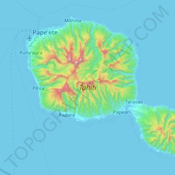
Name: Tahiti topographic map, elevation, terrain.
Location: Tahiti, Windward Islands, French Polynesia, France (-17.88036 -149.62090 -17.49417 -149.12469)
Average elevation: 160 m
Minimum elevation: 0 m
Maximum elevation: 2,139 m