
Col de Pravouta topographic map
Interactive map
Click on the map to display elevation.
About this map
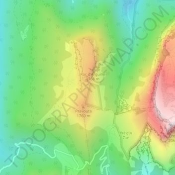
Name: Col de Pravouta topographic map, elevation, terrain.
Average elevation: 1,484 m
Minimum elevation: 1,113 m
Maximum elevation: 2,068 m
Other topographic maps
Click on a map to view its topography, its elevation and its terrain.
Col de Marcieu
France > Auvergne-Rhône-Alpes > Plateau-des-Petites-Roches
Col de Marcieu, Route du Col de Marcieu, Saint-Bernard, Plateau-des-Petites-Roches, Grenoble, Isère, Auvergne-Rhône-Alpes, France métropolitaine, 38660, France
Average elevation: 999 m