
Lonsdale topographic map
Interactive map
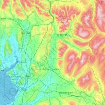
Click on the map to display elevation.
About this map
Name: Lonsdale topographic map, elevation, terrain.
Average elevation: 225 m
Minimum elevation: 0 m
Maximum elevation: 732 m
The river begins as a stream at Newbiggin, in the parish of Ravenstonedale, Cumbria, at St. Helen's Well (elevation of 238 metres above sea level) and some neighbouring springs. On the first two miles of its course, it is joined by four streams, two of them as short as itself, but two much longer. These are the Bessy Beck (short), the Dry Beck of 4.9 kilometres' (three miles) length at 0.32 miles (0.51 km) from St. Helen's Well, the Sandwath Beck (short) at 0.37 miles (0.60 km), and the Weasdale Beck (5.58 km = 3½ mls) at 1.6 miles from the well. Weasdale Beck is the uppermost headwater of River Lune recorded in Environment Agency's Catchment Data Explorer.
Other topographic maps
Click on a map to view its topography, its elevation and its terrain.
Ulverston
United Kingdom > England > South Lakeland > Ulverston
Ulverston, South Lakeland, Cumbria, North West England, England, LA12 7DX, United Kingdom
Average elevation: 83 m
South Lakeland
United Kingdom > England > South Lakeland
South Lakeland, Cumbria, North West England, England, United Kingdom
Average elevation: 209 m
Summerlands
United Kingdom > England > South Lakeland > Summerlands
Summerlands, South Lakeland, Cumbria, North West England, England, LA8 0FB, United Kingdom
Average elevation: 82 m
Heron Island
United Kingdom > England > South Lakeland
Heron Island, South Lakeland, Cumbria, North West England, England, United Kingdom
Average elevation: 173 m