
Ramoth topographic map
Interactive map
Click on the map to display elevation.
About this map
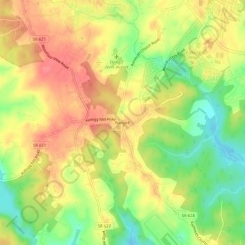
Name: Ramoth topographic map, elevation, terrain.
Location: Ramoth, Stafford County, Virginia, 22463, USA (38.40207 -77.48943 38.44207 -77.44943)
Average elevation: 74 m
Minimum elevation: 36 m
Maximum elevation: 102 m