
Penguin Island topographic map
Interactive map
Click on the map to display elevation.
About this map
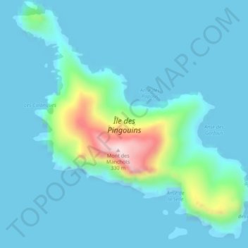
Name: Penguin Island topographic map, elevation, terrain.
Average elevation: 48 m
Minimum elevation: 0 m
Maximum elevation: 354 m
Other topographic maps
Click on a map to view its topography, its elevation and its terrain.
Plateau Central
France > French Southern and Antarctic Lands
Plateau Central, Kerguelen Archipelago, French Southern and Antarctic Lands, France
Average elevation: 116 m