
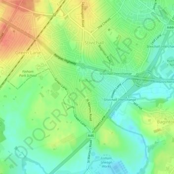
Finham topographic map
Interactive map
Click on the map to display elevation.
About this map
Name: Finham topographic map, elevation, terrain.
Average elevation: 77 m
Minimum elevation: 58 m
Maximum elevation: 103 m
Other topographic maps
Click on a map to view its topography, its elevation and its terrain.
Allesley
United Kingdom > England > Coventry
Allesley, Coventry, West Midlands Combined Authority, England, CV5 9GS, United Kingdom
Average elevation: 115 m