
Sarnia topographic map
Interactive map
Click on the map to display elevation.
About this map
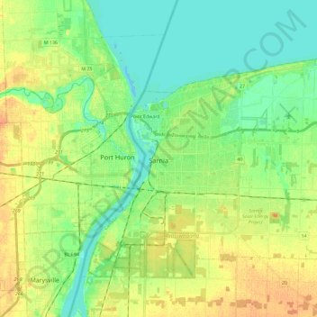
Name: Sarnia topographic map, elevation, terrain.
Average elevation: 186 m
Minimum elevation: 173 m
Maximum elevation: 203 m
Sarnia is located on the eastern shore of Lake Huron at its extreme southern point, where it flows into the St. Clair River. Most of the surrounding area is flat, and the elevation ranges from 169 to 281 m (554 to 922 ft) above sea level. The soil mostly comprises clay. Despite this high percentage of clay, the soil is remarkably rich for cultivation.