
Inglis topographic map
Interactive map
Click on the map to display elevation.
About this map
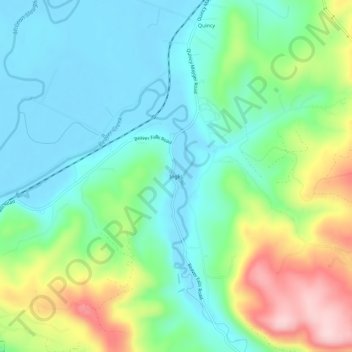
Name: Inglis topographic map, elevation, terrain.
Location: Inglis, Columbia County, Oregon, USA (46.10650 -123.18512 46.14650 -123.14512)
Average elevation: 76 m
Minimum elevation: -3 m
Maximum elevation: 252 m