
ນຳ້ງໍ topographic map
Interactive map
Click on the map to display elevation.
About this map
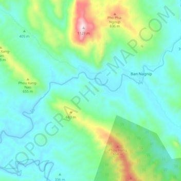
Name: ນຳ້ງໍ topographic map, elevation, terrain.
Location: ນຳ້ງໍ, ເມືອງວຽງທອງ, Provinz Bolikhamsai, Laos (18.46274 104.34840 18.51104 104.43658)
Average elevation: 437 m
Minimum elevation: 254 m
Maximum elevation: 1,069 m