
Hartlip topographic map
Interactive map
Click on the map to display elevation.
About this map
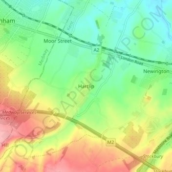
Name: Hartlip topographic map, elevation, terrain.
Location: Hartlip, Kent, South East, England, ME9 7TL, United Kingdom (51.32806 0.61952 51.36806 0.65952)
Average elevation: 52 m
Minimum elevation: 6 m
Maximum elevation: 121 m