
Belyuen topographic map
Interactive map
Click on the map to display elevation.
About this map
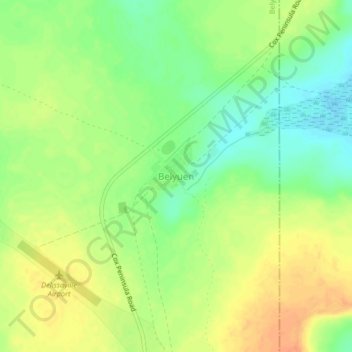
Name: Belyuen topographic map, elevation, terrain.
Location: Belyuen, Belyuen Shire, Northern Territory, Australia (-12.55941 130.68074 -12.51941 130.72074)
Average elevation: 23 m
Minimum elevation: 3 m
Maximum elevation: 42 m
Other topographic maps
Click on a map to view its topography, its elevation and its terrain.
Cox Peninsula
Australia > Northern Territory > Belyuen
Cox Peninsula, Belyuen, Northern Territory, Australia
Average elevation: 26 m