
Pica topographic map
Interactive map
Click on the map to display elevation.
About this map
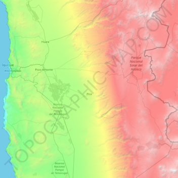
Name: Pica topographic map, elevation, terrain.
Location: Pica, Provincia del Tamarugal, Región de Tarapacá, Chile (-21.28548 -69.47729 -19.60050 -68.43876)
Average elevation: 2,300 m
Minimum elevation: 0 m
Maximum elevation: 6,145 m