
St. Michael topographic map
Interactive map
Click on the map to display elevation.
About this map
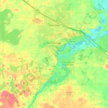
Name: St. Michael topographic map, elevation, terrain.
Location: St. Michael, Wright County, Minnesota, 55376, USA (45.15103 -93.76600 45.23830 -93.55230)
Average elevation: 290 m
Minimum elevation: 260 m
Maximum elevation: 328 m