
Carro topographic map
Interactive map
Click on the map to display elevation.
About this map
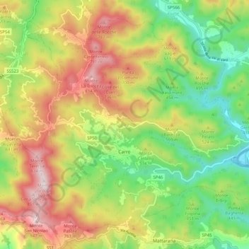
Name: Carro topographic map, elevation, terrain.
Location: Carro, SP, Ligurien, Italien (44.24997 9.56716 44.31114 9.66725)
Average elevation: 470 m
Minimum elevation: 167 m
Maximum elevation: 855 m