
Forest Lake topographic map
Interactive map
Click on the map to display elevation.
About this map
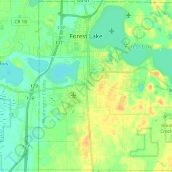
Name: Forest Lake topographic map, elevation, terrain.
Average elevation: 279 m
Minimum elevation: 267 m
Maximum elevation: 298 m
Other topographic maps
Click on a map to view its topography, its elevation and its terrain.
Forest Lake
United States > Minnesota > Washington County > Forest Lake > Forest Lake
Forest Lake, Washington County, Minnesota, 55025, United States
Average elevation: 277 m
Oakdale
United States > Minnesota > Washington County
Oakdale, Washington County, Minnesota, 55128, United States
Average elevation: 302 m