
Taggia topographic map
Interactive map
Click on the map to display elevation.
About this map
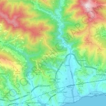
Name: Taggia topographic map, elevation, terrain.
Location: Taggia, Imperia, Liguria, 18018, Italy (43.82834 7.79775 43.91399 7.88054)
Average elevation: 374 m
Minimum elevation: 0 m
Maximum elevation: 1,148 m