
St. Stefan-Afiesl topographic map
Interactive map
Click on the map to display elevation.
About this map
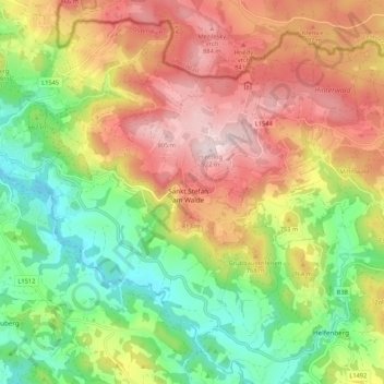
Name: St. Stefan-Afiesl topographic map, elevation, terrain.
Location: St. Stefan-Afiesl, Rohrbach, Oberösterreich, Österreich (48.53893 14.06263 48.59775 14.16902)
Average elevation: 701 m
Minimum elevation: 508 m
Maximum elevation: 922 m