
Cowaramup topographic map
Interactive map
Click on the map to display elevation.
About this map
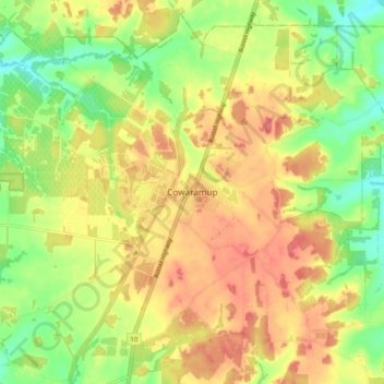
Name: Cowaramup topographic map, elevation, terrain.
Location: Cowaramup, Western Australia, 6284, Australia (-33.89127 115.06297 -33.81127 115.14297)
Average elevation: 121 m
Minimum elevation: 82 m
Maximum elevation: 155 m
Western Australia trails, hiking, mountain biking, running and outdoor activities
Other topographic maps
Click on a map to view its topography, its elevation and its terrain.