
Scituate topographic map
Interactive map
Click on the map to display elevation.
About this map
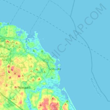
Name: Scituate topographic map, elevation, terrain.
Location: Scituate, Plymouth County, Massachusetts, USA (42.12522 -70.83882 42.30458 -70.62468)
Average elevation: 13 m
Minimum elevation: -3 m
Maximum elevation: 78 m