
São Vicente topographic map
Interactive map
Click on the map to display elevation.
About this map
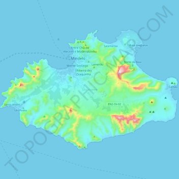
Name: São Vicente topographic map, elevation, terrain.
Location: São Vicente, Cape Verde (16.77660 -25.08599 16.92262 -24.85944)
Average elevation: 46 m
Minimum elevation: -2 m
Maximum elevation: 716 m
Other topographic maps
Click on a map to view its topography, its elevation and its terrain.