
Mons topographic map
Interactive map
Click on the map to display elevation.
About this map
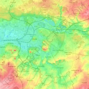
Name: Mons topographic map, elevation, terrain.
Location: Mons, Hainaut, Wallonia, Belgium (50.37771 3.85449 50.51382 4.08517)
Average elevation: 70 m
Minimum elevation: 17 m
Maximum elevation: 148 m
Other topographic maps
Click on a map to view its topography, its elevation and its terrain.