
Matlock topographic map
Interactive map
Click on the map to display elevation.
About this map
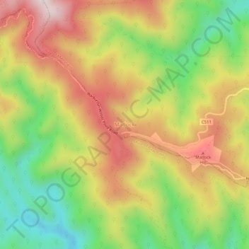
Name: Matlock topographic map, elevation, terrain.
Location: Matlock, Shire of Mansfield, Victoria, Australia (-37.61854 146.18771 -37.57854 146.22771)
Average elevation: 1,026 m
Minimum elevation: 731 m
Maximum elevation: 1,326 m