
Charlton topographic map
Interactive map
Click on the map to display elevation.
About this map
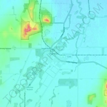
Name: Charlton topographic map, elevation, terrain.
Location: Charlton, Shire of Buloke, Victoria, 3525, Australia (-36.30861 143.31182 -36.22861 143.39182)
Average elevation: 137 m
Minimum elevation: 124 m
Maximum elevation: 221 m
Victoria trails, hiking, mountain biking, running and outdoor activities